
Located 2,750 km northwest of Perth and 900 km from Christmas Island, the Cocos Islands are a group of coral islands forming two atolls. Only two of the 27 islands are inhabited – the rest is waiting to be explored.
Welcome to the Cocos Islands
Australia’s last unspoiled paradise is located in the blue waters of the Indian Ocean and offers spectacular snorkeling, breathtaking diving, excellent fishing, and the adrenaline rush of kitesurfing. The deserted beaches are perfect for relaxation, but there are other activities to enjoy: visiting uninhabited islands by canoe, observing the magnificent birdlife, or taking the ferry to Home Island to discover the culture and traditions of the Cocos Malay people. Consisting of 27 islands, only two are inhabited. Let’s look at the three most well-known and visited islands.
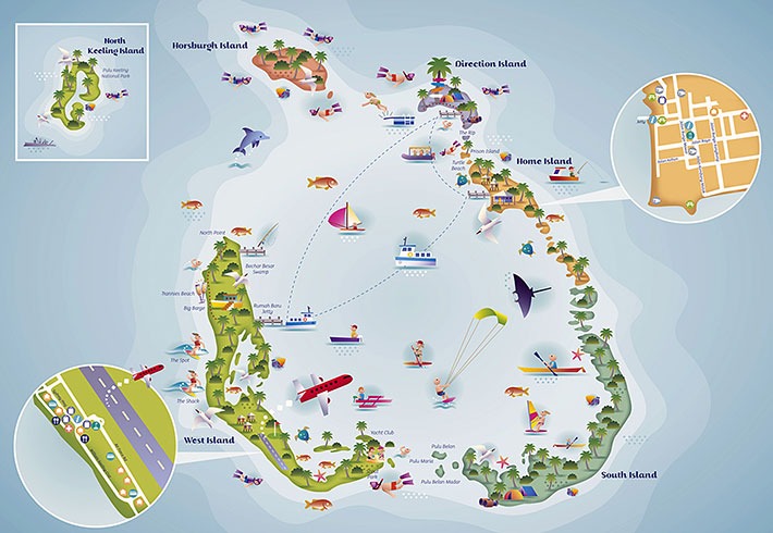
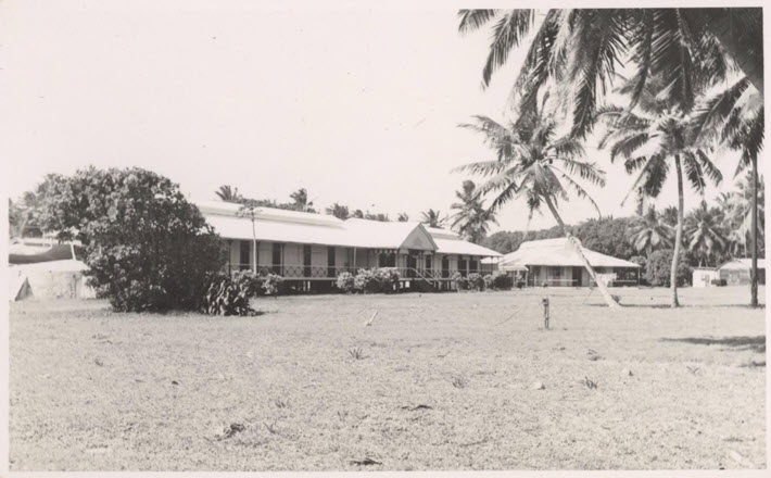
West Island
This is the island where most tourists choose to stay and where the airport is located. You’ll find a selection of holiday homes, luxury bed and breakfasts, and resorts. West Island is also home to the Cocos supermarket, souvenir shop, visitor center, car rental center, water sports facilities, and a small selection of cafes and restaurants.
Home Island
It has approximately 500 inhabitants of Malaysian descent. When visiting the island, conservative dress is recommended to respect the residents’ religion.
There are some shops, a bar, and you can buy petrol and gas, but generally, the offerings are very limited.
We took advantage of the Saturday ferry and went straight to the grocery store to buy fresh items as Tony (the West Island baker) told us that supplies would arrive overnight and fresh items would sell out quickly. Ice is rare to find at the grocery store. However, we discovered that the mosque has its own ice machine and local people can get ice for $3 per bag. It’s self-service, with the key outside to enter the facility, and you can help yourself, leaving the money afterward.
Keep in mind that the only thing open on Saturday is the grocery store. We were lucky that there was an activity at the sailing yacht and we found food for lunch.
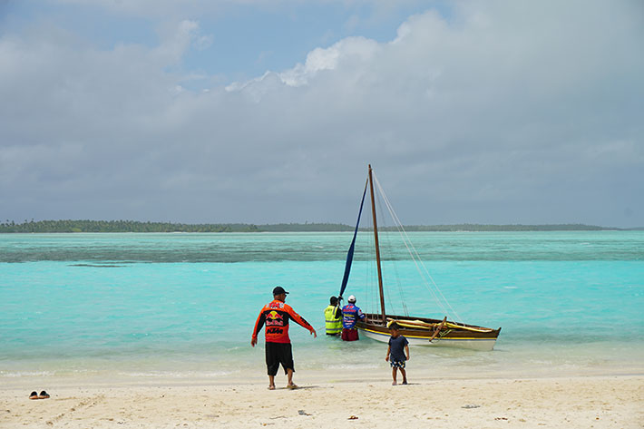
Direction Island
It’s a deserted island used by sailors. It remains close to the anchorage. The island has only a hut, a barbecue, a rainwater collection system, an emergency phone, and a Wi-Fi hotspot. The ferry to Home Island stops here once a week, on Saturdays.
We didn’t see any dangerous animals on the island. In the water, there are blacktip reef sharks, which are small and reach a maximum length of 1.6 meters. They are harmless as long as you don’t provoke them or feed them, and they swim away as soon as you enter the water.
Getting around the Cocos Islands
From Direction Island, there’s only a ferry on Saturdays.
The ferry from Direction Island to Home Island departs at 10:00, while from Home Island to Direction Island it departs at 15:00.
It’s recommended to write or call the tourism office to get updated schedules.
The cost is $2.50 per person/trip.
Between Home Island and West Island, there are several ferries running daily except Sundays, but there’s no connection with the one arriving from Direction Island on Saturdays, so if you want to go to West Island, the only way is to go to Home Island by dinghy.
Going to West Island by dinghy is very long, about 40 minutes with a 20 HP outboard. Also, keep in mind that the SE wind is quite strong in August and makes it difficult to move around by dinghy. It’s better to wait for a day when the trade winds calm down a bit.
Before departing with the dinghy to another island, it’s better to call the Border Force on VHF (channel 20) stating where you want to go and how long the crossing is expected to take. Once you arrive at your destination, call them again confirming your arrival. In case of engine failure, with 20-25 knots of SE wind, there’s a danger of drifting NW, leaving the atoll and getting lost at sea.
Time
The time here is UTC + 6:30.
Internet and Telecommunications
After 12-15 days of sailing, someone might need to connect to the Internet.
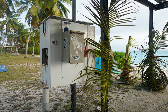
The island no longer has submarine cables, and all telecommunications go through satellite. The Community Resource Centre offers internet access via voucher or direct credit card payment once connected to one of the available hotspots.
These can be found at: Cocos Cottages, Cocos Beach Motel, Cocos Village Bungalows, Cocos Castaway, My Island Home, the Cocos Club, the Golf Donga, Maxi’s By The Sea, the Pondok and in the main hut on Direction Island.
The rates are as follows: be aware that it activates from the first login and even if you disconnect, the time continues. It’s also tied to the device you log in with. The same subscription works at all hotspots on this network present on the islands.
| 1x hour | $4.95 (Quota: 150MB) |
| 3x hours | $9.95 (Quota: 350MB) |
| 1x day | $19.95 (Quota: 750MB) |
| 1x week | $64.95 (Quota: 2500MB) |
There’s no mobile network on Direction Island, but there’s a phone for free calls to all numbers on the islands.
Useful Numbers
Cocos Keeling Islands Visitor Centre
P: 9162 6790
E: info@cocoskeelingislands.com.au
Tony’s Bakery: makes good bread, you need to call the day before and then arrange to pick it up or ask if he comes to the island.
P: 9162 6616
Taxi boat: it’s not official, but the guy (Shia) is available
P: 916 27 525
Shell West Island: channel 20 VHF or phone 08 9162 6670
Arriving at Cocos Islands
You must announce your arrival between 96 hours and 90 days in advance.
This can be done using the following contacts:
- email yachtreport@homeaffairs.gov.au
- fax +61 2 6275 5078
- phone +61 2 6246 1325.
The Approach
When approaching the 12-mile limit, you need to call “Cocos Police” on VHF channel 20, announcing your arrival. If you don’t have an AIS transponder, the Border Force ship permanently stationed at the atoll entrance might call for verification. This doesn’t exclude the fact that you still need to call and announce your arrival to the police.
Be prepared to answer questions about position, anchorage ETA, number of people/weapons/animals on board and more. The police monitors channel 20 24/7, call every 30 minutes until you receive a response.
Arrival at Direction Island
Raise the Q flag. If arriving at night, it’s better to anchor outside and enter with daylight. It seems some charts don’t match with GPS: we didn’t notice any problems with the latest Navionics charts. Despite finding different versions online about entry and exit formalities, for us it was very simple. Just follow the instructions given via radio. We arrived on Friday and were told to go to the police on Home Island on Monday. However, on Saturday we met the police who already gave us entry forms to fill out for each person. So on Monday only the captain went with the usual documents and was able to arrange the exit for the following Friday. No one came aboard to check food.
A Bit of History about Cocos Islands
Discovered in 1609 by William Keeling and uninhabited until 1826, the Cocos Islands were administered by the United Kingdom between 1857 and 1955, when they were transferred from the Singapore colony to Australia and gained external territory status. However, the islands remained effectively under the control of the Clunies-Ross family who had established a settlement on the islands in 1827 and held power from 1831, with the family head becoming known as King of the Cocos (Keeling) Islands. In 1886, Queen Victoria had granted the family perpetual possession of the islands.
In 1974, a United Nations mission to the islands drew attention to the territory’s governance methods and raised concerns about the denial of fundamental freedoms to residents. The UN criticized the Australian government for not properly administering the islands. Consequently, in 1978 the Australian government purchased all island lands, except for the Clunies-Ross house, for $4.75 million. A second United Nations visit in 1980 reported positively on the reforms.
Although there was no pressure from the UN to hold a self-determination referendum due to recognition of the islands’ small size, the Australian government chose to proceed with a referendum.
The Battle of Cocos
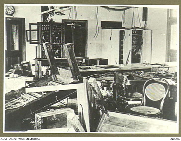
On Direction Island, there was a cable and radio station, and it was a crucial point for connecting Australia with Europe. The Durban – Mauritius – Rodriguez Island – Cocos – Perth and Adelaide connection passed through here.
On the morning of November 9, 1914, the staff at Direction Island’s cable and radio station saw a warship approaching. Having previously received an alert about the German ship SMS Emden, the radio operator sent a message: “Strange warship approaching”. This was soon followed by “SOS! Emden is here!”. These messages were received by a passing troop convoy, and one of the escorts, HMAS Sydney, was sent at full speed toward Direction Island.
The captain of SMS Emden, Fredrich von Muller, sent ashore a team of fifty men and officers with instructions to destroy the equipment and cut the cables. The station staff was gathered and put under surveillance, while part of the German team set about destroying the instruments and trying to cut the cables. They only succeeded with the Perth cable but not with the one to South Africa.
While this operation was ongoing, the crew remaining aboard the Emden saw smoke on the horizon and assumed it was their collier Buresk. However, realizing the approaching ship was a warship, they recovered the anchor and signaled the shore party to return. Unable to reach the Emden, the shore party headed for Clunies Ross’s schooner “Ayesha”, anchored in the lagoon. They used Ayesha to sail to the Dutch East Indies, where they later boarded a German steamship that took them to Turkey. From Turkey, they traveled by land, reaching Germany seven months after leaving Cocos.
Today no construction remains on the island: everything was leveled and thrown into the sea (you can still see some concrete blocks on the northwest coast), while telecommunications are now done via satellite and there are no more cables on the atoll.
Subscribe to the newsletter to not miss the next articles!
Last update: